
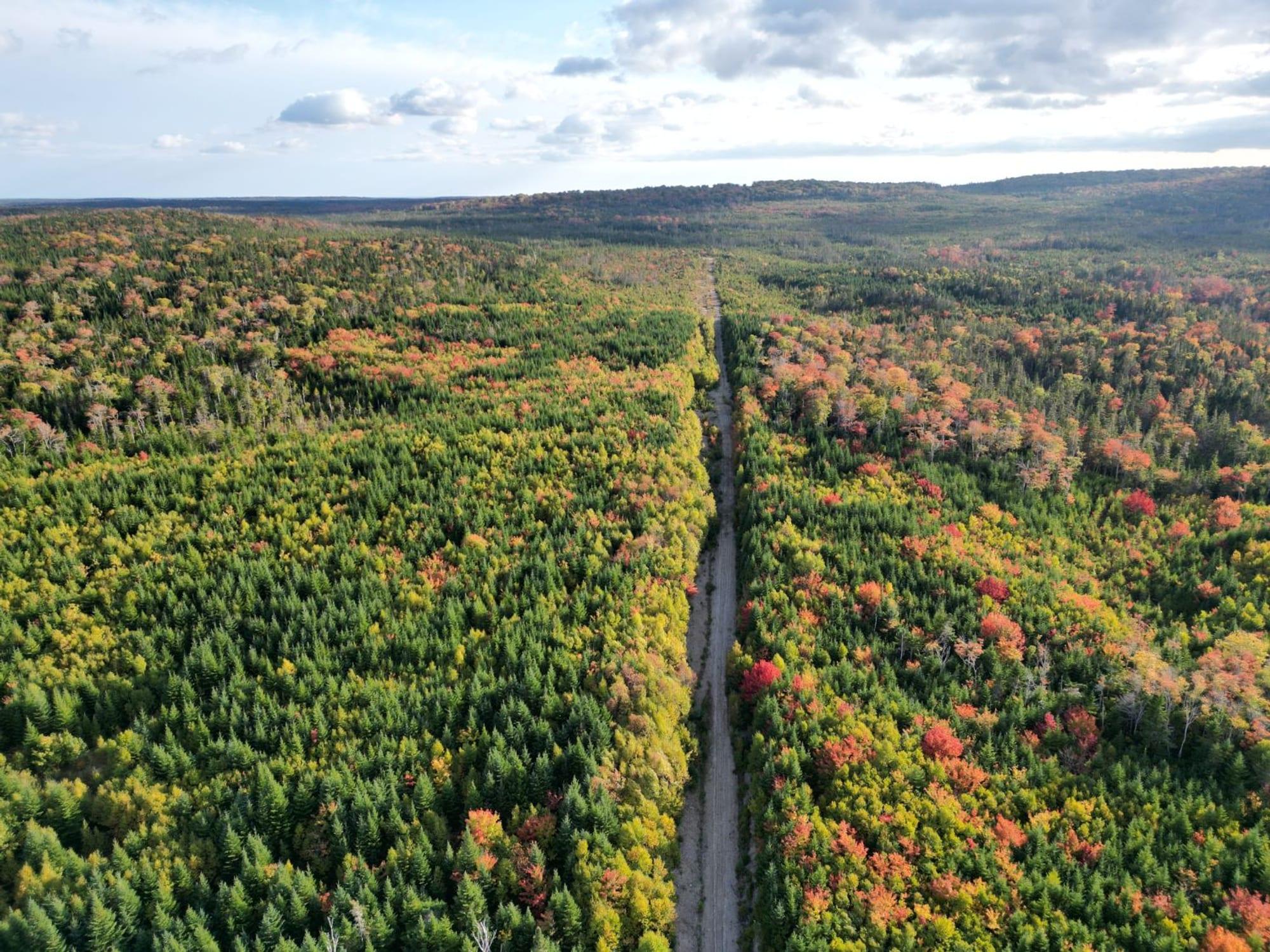
A stacked vein system in the historic Country Harbour Gold District of Guysborough County. Drilling has repeatedly intersected high-grade gold, including visible gold, in a style of deposit unique in Nova Scotia.
Widow Point is a stacked vein system in the historic Country Harbour Gold District of Guysborough County. Drilling has repeatedly intersected high-grade gold, including visible gold, in a style of deposit unique in Nova Scotia.
Location
The Widow Point Property lies in the Country Harbour Gold District of Guysborough County, about 55 km southeast of Antigonish, Nova Scotia. It is reached by Highway 316 to Cross Roads Country Harbour, then about 9 km southeast along a recently upgraded government road that runs through the centre of the claims. The property borders Country Harbour, one of the finest natural deep-water harbours on the eastern seaboard.
Geology
Widow Point hosts high-grade lode gold mineralization considered unique within the Goldenville Formation of Nova Scotia. Here the Goldenville rocks have been strongly altered and rotated more than 90 degrees to a north-northwest strike.
Gold is associated with an intense stockwork of quartz veining in altered slates (now chlorite-biotite schist) interbedded with greywacke, on the flank of a granitic intrusion. Visible gold has been observed in drill core in several programs.
History
Widow Point has a long record of exploration, including an old shaft and adit on the central zone.
- 1948: Highland Gold Limited carried out operations on the property.
- 1983-1984: Outland Resources completed geological work, trenching, drilling, bulk sampling and mineral processing tests with Lakefield Research.
- 1987: Drilling by Cobequid Resources returned high-grade intercepts including 28.38 g/t Au over 0.83 m (WP87-11) and 18.34 g/t Au over 0.8 m (WP87-18).
- 2002-2006: Rainbow Resources compiled historical data and completed prospecting, rock sampling, soil geochemistry and trenching.
- 2010: Five diamond drill holes were completed. Two intersected visible gold.
- 2012: Two holes totalling 400 m traced mineralization down dip, with WP12-01 returning 19.3 g/t Au over 0.5 m and 4.94 g/t Au over 0.4 m (O'Sullivan, 2013).
- 2014: Four holes totalling 635 m, supported by a Nova Scotia Advanced Project Grant. WP14-02 intersected 37.0 g/t Au over 0.5 m at 96 m depth, interpreted as the down-dip continuation of the 1987 high-grade zone. WP14-03 returned visible gold near surface (O'Sullivan, 2015).
Exploration Plans
Our geologists are finalizing exploration plans for the fall and winter months. Previous work recommends closely spaced drilling in the high-grade central zone, followed by a resource estimate to guide further drilling. Building on this, Freedom Gold plans to extend the known mineralized system and develop a geological model to support that future resource estimate. The Company will also generate new targets along the granite contact, using historical soil sampling and trenching results.
Gallery

Drone photo of Widow point property, looking south. 2025 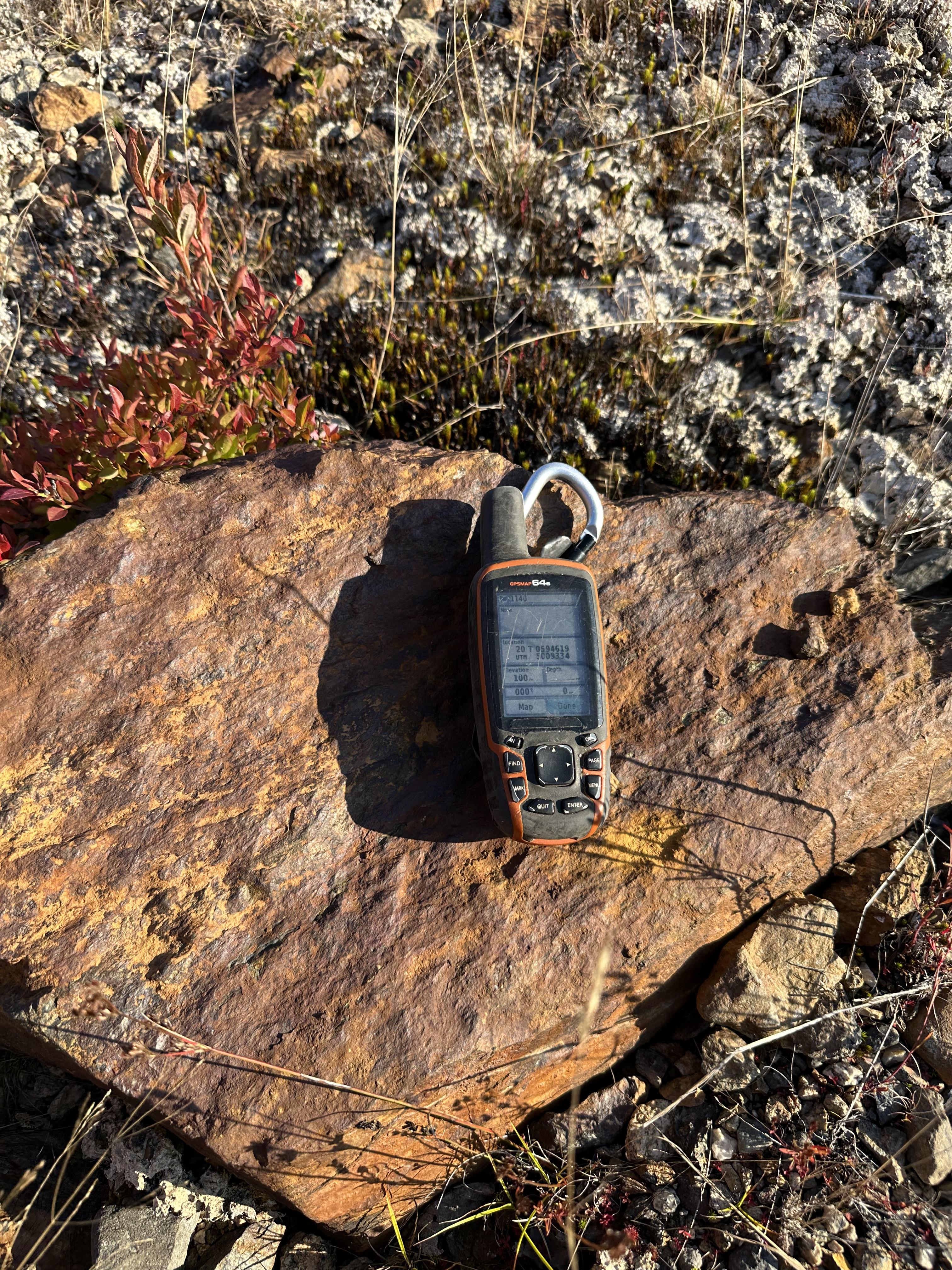
Rusty schist at Widow Point. 0.451 g/t gold.
Forward-Looking Statements
All statements on this website about anticipated future events or results constitute forward-looking statements, including, but not limited to, statements with respect to the Company's exploration plans, the potential of its mineral properties, financings and the use of proceeds, and the timing and results of future exploration programs. Forward-looking statements are often, but not always, identified by the use of words such as “seek”, “anticipate”, “believe”, “plan”, “estimate”, “expect” and “intend” and statements that an event or result “may”, “will”, “should”, “could” or “might” occur or be achieved and other similar expressions. Although Freedom Gold Corp. (“Freedom” or the “Company”) believes that the expectations reflected in such forward-looking statements are reasonable, undue reliance should not be placed on them since the Company can give no assurance that such expectations will prove to be correct. These statements involve known and unknown risks, uncertainties and other factors that may cause actual results or events to differ materially from those anticipated, including risks associated with the business of Freedom; risks related to exploration and potential development of the Company's mineral properties; business and economic conditions in the mining industry generally; fluctuations in commodity prices and currency exchange rates; uncertainties relating to interpretation of drill results and the geology, continuity and grade of mineral deposits; the need for cooperation of government agencies and First Nation groups and the issuance of required permits; the need to obtain additional financing and uncertainty as to its availability and terms; the possibility of delay in exploration or development programs; and other risk factors identified in Freedom's filings with Canadian securities regulators on SEDAR+. Forward-looking statements are based on estimates and opinions of management at the date the statements are made. Freedom does not undertake any obligation to update forward-looking statements except as required by applicable securities laws.
Historical exploration results referenced on this website have not been independently verified by the Company and should not be relied upon. Technical information on this website has been reviewed and approved by Mr. Martin Demers, P.Geo. (APEGNB L5980), a technical advisor to the Company and a Qualified Person as defined by National Instrument 43-101.
The Canadian Securities Exchange has not reviewed and does not accept responsibility for the adequacy or accuracy of the content of this website.